In a recent paper published in TECTONICS, scientists present the findings of a joint Turkmenistan-UK project on the active tectonics of the territory of Turkmenistan. Tectonic relates to the structure of the earth’s surface and the way it is formed, changed, and moved by inside forces.
Turkmenistan has experienced destructive earthquakes including the devastating earthquake in 1948 with magnitude of 7.3 east of the Main Kopetdag Fault (MKDF), and earthquakes in Caspian lowlands with magnitudes of 6.0–7.5 in 1895, 1946, and 2000. There is no historic record of significant earthquakes over the length of MKDF. However, given that it is 200 kilometres long, the MKDF is theoretically capable of producing large earthquakes with magnitude of > 7.5. Therefore, measuring fault’s slip-rate is important for estimating the earthquake hazard that it poses.
A fault is when a rock breaks into two blocks and separates from each other. When these two blocks slip past one another an earthquake happens. The surface where they slip is called the fault. The slip rate is how fast the two sides of the fault are slipping relative to one another.
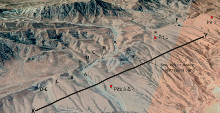
In November 2016, a joint team of scientists from Turkmenistan and UK visited the MKDF to measure its long-term slip-rate. They determined that the slip rate is accumulating rapidly, at 9.1 ± 1.3 mm/yr, making it one of the fastest faults in the entire Arabia-Eurasia collision zone. This fast slip-rate suggests that it is a zone of high earthquake hazard. Paleoseismic investigation, which involves understanding the long-term patterns of large earthquakes, is required to predict the timing and occurrence of earthquake.